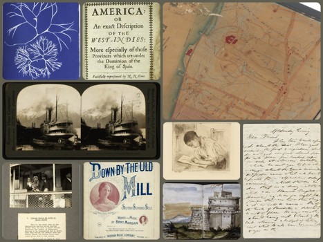
The New York Public Library announced this month that out-of-copyright materials in NYPL Digital Collections are now available as high-resolution downloads, and its lab team has provided wonderful tools to help use these items — even creating a Minecraft world from an 1860 map of Manhattan! The collection includes historic photographs, works of art, original sheet music, antique books and maps, lithographs, scientific slides, letters from famous Americans and much more. All 180,000 plus items are free to use.
Some of the items now available for download include:
- Papers and correspondence of founding American political figures like Alexander Hamilton, Thomas Jefferson, and James Madison
- Lewis Hine’s photographs of Ellis Island immigrants and social conditions in early 20th century America
- Anna Atkins’ cyanotypes of British algae, the first recorded photographic work by a woman (1843)
- Manuscripts of American literary masters like Walt Whitman, Henry David Thoreau, and Nathaniel Hawthorne
- Sheet music for popular American songs at the turn of the 20th century
- Berenice Abbott’s iconic documentation of 1930s New York for the Federal Art Project
- Farm Security Administration photographs by Walker Evans, Dorothea Lange, Gordon Parks, and others
- Medieval and Renaissance illuminated manuscripts from Western Europe
- Over 20,000 maps and atlases documenting New York City, North America, and the world
- WPA-era lithographs, etchings, and pastels by African American artists
- More than 40,000 stereoscopic views documenting all regions of the United States
- Handscrolls of the Tale of Genji, created in 1554
In addition, the NYPL Labs team has released several demonstration projects that delve into specific collections in order to inspire users to find novel ways to use the collection. Some of these creative projects include:
- Historic Maps in Minecraft, which converted an 1860 map of the Fort Washington area of Manhattan into a three-dimensional Minecraft world;
- a “mansion builder” game, exploring floor plans of grand turn-of-the-century New York apartments;
- a then-and-now comparison of New York’s Fifth Avenue, juxtaposing 1911 wide angle photographs with Google Street View; and
- a “trip planner” using locations extracted from mid-20th century motor guides that listed hotels, restaurants, bars, and other destinations where Black travelers would be welcome.
The educational possibilities for the collection are endless. These items can enrich studies in history, art, science, geography and more. Images could be used for lapbooking, notebooking, online projects, reports or simple exploration. This is a wonderful resource for kids and adults alike.


